The cultural Landscape today
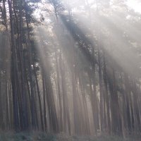
In the main, the appearance of the Lower Saxonian Elbe Valley Biosphere Reserve is determined by large scale agricultural usage and forestry operations. Woods, grasslands and arable land cover approximately equal areas. The size of the fields and meadows in the district of Amt Neuhaus, which used to be part of the German Democratic Republic, is noticeably larger than those of the districts of Dannenberg and Gartow on the west bank, a reminder of the differing political priorities set by the two German states.
To ensure that the water within the dyked areas can find its way to the Elbe, the land is criss-crossed with an extensive system of ditches. Some of these trace the routes taken by the original natural flood channels and previous courses of the Elbe. The generally open landscape is enriched by majestic solitary oaks, avenues of fruit trees and oaks, hedges and spinneys. And everywhere there are traces of the ancient primeval valley to be found in the form of smaller bodies of water, thickets of rushes and reed beds and so forth.
Human settlements in the biosphere reserve are generally of a rural nature. The population density of 35 inhabitants per square kilometre is quite low for European standards. The road traffic infrastructure is not very dense, but provides an effective network connecting the villages and working areas of the region. There is a road bridge over the Elbe at Dömitz and vehicle ferry services at Schnackenburg, Pevestorf, Neu Darchau and Bleckede. The Elbe itself is a major international transport route, used mainly for freight.

In the main, the appearance of the Lower Saxonian Elbe Valley Biosphere Reserve is determined by large scale agricultural usage and forestry operations.


 deutsch
 english