


 Bildrechte: B.Königstedt
Dykes and Groynes
The use of dykes to protect people and property has a long history. Originally, dykes were thrown up locally as a direct protection for individual settlements, and with time the technology was modified to provide wholesale protection for complete regions by constructing dykes along major waterways. For the Elbe, the systematic management of floodwater in this way can be dated to the 16th century. In the 17th century, Frederick II of Prussia ordered the flood prevention measures to be extended downstream as far as Lauenburg. Even though the maintenance of the dykes was given very high priority and it counted amongst the most important communal duties for the local populations, chronicles bear frequent witness to flood damage and catastrophes resulting from breached dykes. The list of memorable dates is long and continues up until the present day: 1784, 1799, 1805, 1830, 1845, 1855, 1862, 1871, 1888, 1895, 1920, 1926/27, 1940/41, 1946, 1947, 1954, 1958, 1965, 1974/75, 1981, 1988, 2002, 2003, 2006, 2011 and most recently 2013. Many small bodies of water in the vicinity of the dykes came into being as a result of such incidents. Locally, these waters are called ‘Bracks’.
When the Elbe waters are unusually high and the amount of water to be drained reaches a certain volume, the tributary rivers are held back, so they rise as well and overflow into the surrounding land. During the second half of the twentieth century major works were carried out to deal with this threat, involving the construction of dykes, weirs and pumping stations. For instance, works were carried out on the Jeetzel between 1952 and 1972, and then resumed from 2003 until 2006 on account of the Elbe floods which occurred in 2002. When the barrage across the Elbe at Geesthacht was constructed in 1959, comprehensive flood protection measures were carried out at the same time which involved both the Sude and its tributaries the Krainke and Rögnitz.
Finally, in the early 1970s the mouth of the Löcknitz was moved downstream to Wehningen by means of a 12 km long canal. This measure was designed to protect the lowlands further upstream in the area known as the ‘Lenzener Wische’.
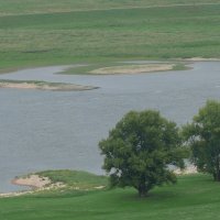
Groynes are breakwaters which project from the banks towards the main stream in order to regulate the flow and maintain the river’s navigability. When the Elbe began to increase in importance as a transport route in the 18th century, the bordering states adopted appropriate supportive measures. In addition to the construction of groynes, islands were removed and a number of short cuts were dug from one section of the meandering river to another. By 1892 the river’s navigability had been largely secured by means of groynes and longitudinal constructions.
Bildrechte: B.KönigstedtGroynes are breakwaters which regulate the flow and maintain the river's navigability.
 deutsch
 english